Fukushima Daiichi nuclear power plant before the 11 March 2011 disaster
Feb 2013 map showing the areas most contaminated by radioactive fallout from Fukushima Daiichi nuclear power plant, created by Professor Yukio Hayakawa of Gunma University, from a combination of government and citizen dataRadioactive contamination of the Pacific ocean by Fukushima Daiichi nuclear power plantThe contamination travelled around the world: map showing the distribution of Cesium 137 fallout, just one of the many radioactive materials released from Fukushima Daiichi nuclear power plant in 2011
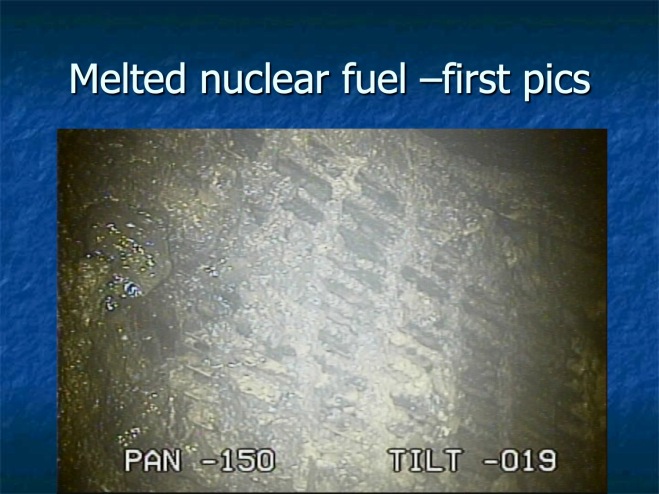
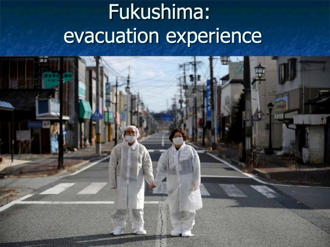
Radiation dose rate inside reactor 1plus: as recently reported by Fukuleaks, highly radioactive microparticles of nuclear fuel scattered unevenly for at least 100km – serious risk to health if these become airborne and are inhaled1m3 plastic bags, each one containing 1 tonne of radioactively contaminated topsoil or vegetation, cleared from fields, gardens, roadsides and parksCouple standing in a deserted high street inside the evacuation zone in FukushimaInfant being scanned for radioactive contamination during the March 2011 disaster